We are honored to announce our latest collaboration with MarineTraffic, the leading company of Global Ship Tracking Intelligence company.
Boaters can now explore nearby place suggestions based on vessels AIS positions through our newly developed API. Straight through the Vessel Details page of the MarineTraffic website, users can find the “Nearby beaches & shelters” section. The feature shows the aggregated number of beaches and overnight shelters according to the nearby top destination. Below, you can find the georeferenced aerial ‘Coast View‘ photo.
As Dimitris Lekkas, Founder of MarineTraffic states: “MarineTraffic cooperates with keeano to help you explore the coastline and find the perfect shelter to spend the night on your boat or the most beautiful nearby beach to swim.”
Travelers on the passenger boats on course towards their destinations or inbetween ferry hops can discover nearby beaches instantly. They can now plan their vacations beforehand or even use these suggestions for future plans.
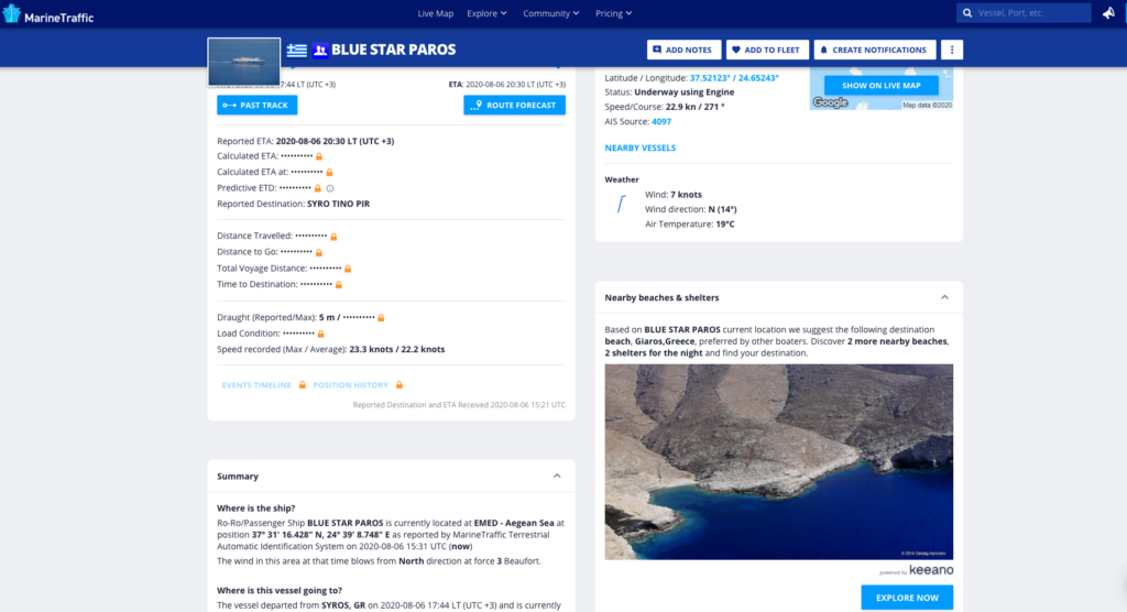
Check it our now as seen in Blue Star Paros
“In times of social distancing, communities can emerge stronger than ever. We are thrilled to announce our partnership with the top ship tracking company, MarineTraffic. Boaters seeking vessel traffic details are now empowered by the wealth of information around the Coastline.” as Ilias Bogordos, CEO @keeano claims.
Faithful to our mission to become the ultimate coastline exploration app, we take this collaboration as an opportunity to offer centralized information that gives value to the users.
Visit MarineTraffic’s blog to read more