Coast View, our in-app feature that helps boaters and kayakers plan their sea trips, has recently become free to use! Everyone can access the coastlines of the Mediterranean Sea in 8 countries via aerial georeferenced photos and explore all the length swipe by swipe.
But our vision goes— or better yet, flies — way beyond that! We are now expanding beyond the Mediterranean with the help of the community for the first time.
Our mission has begun! It’s happening with the valuable contribution of drone operators around the world mapping the coastlines nearby!
What’s the ultimate goal?
Firstly, access to the global coastlines to every explorer out there via aerial shots taken by the community, for the community!
With our first 3 crowdsourced missions (completed in January 2021), we’re just getting started! 97.3% of the world’s coastline still to go…
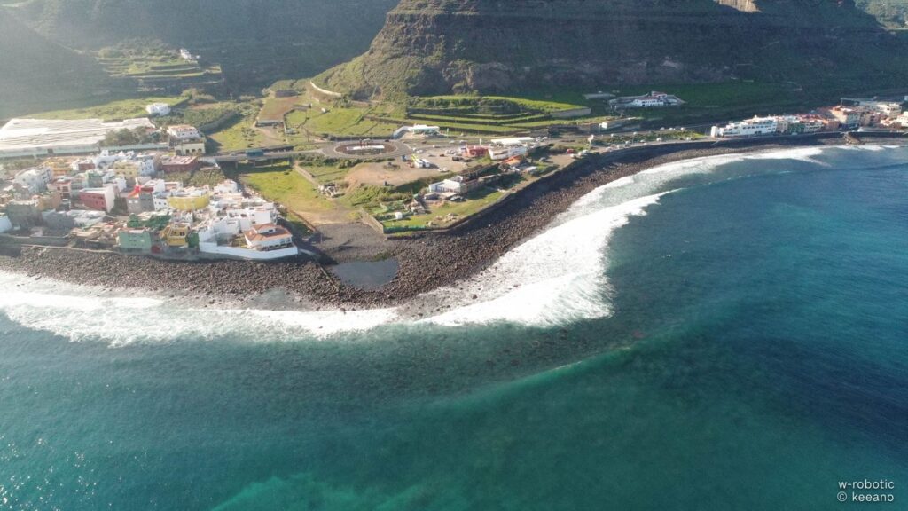
1. Boquini Beach, Gran Canaria Mission
The breath-taking Boquini beach is a wide-open cove with sand and cobble on the shore. It is an isolated beach although there are buildings along the coastline, as there are no amenities provided. The beach is accessible by road and on foot, through a natural path.
The green landscape of the mainland and the deep waves of the waters clash and provide this tropic view! The beach faces the North and has strong waves most of the times!
The Gran Canaria Mission would have been impossible without Marcos García. Marcos flew his drone and mapped Boquini beach in El Pagador of Gran Canaria in Spain. Here is our first Coast View photo in the whole Canary Islands region!
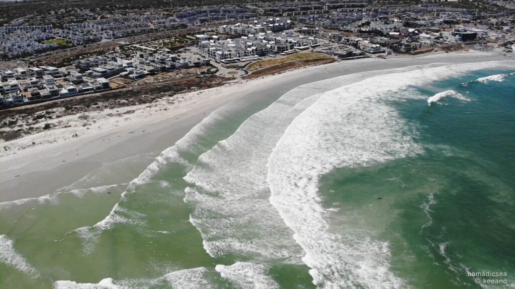
2. Big Bay beach, Cape Town Mission
Down south in Africa, this open beach is split in two by a rocky part, the Big Bay beach, and the Little Bay, located in the region Bloubergstrand of Cape Town. The wavy, untamed Big Bay beach was mapped by photographer, editor, and surfer Dylan Anthony Osborne of the Nomadic Sea team!
Dylan’s aerial shots of the beach allow us to see the rocky parts inside the seabed and the details of the topography. The beach is ideal for surfing, kite-surfing and wind-surfing, thanks to high winds and strong waves.
The sandy beach that attracts athletes and spectators for its annual competitions, however, is ideal for families as well. Equipped with amenities for food and drink, and with a spectacular ocean sunset view, this beach caters to all needs.
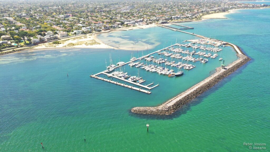
3. Middle Brighton Pier, Melbourne Mission
At the World Down Under, also known as Terra Australis, the Southern Land, Peter Vossos, another friend of ours, accomplished the mapping of Middle Brighton Pier in South Wales of Melbourne with his drone.
Located opposite the pet-friendly Brighton beach, this small marina also has a breakwater path, along which visitors can enjoy the beautiful view of the whole bay.
The marina is perfect for recreational purposes, mainly for yachts or fish boats, while Brighton beach is popular for its all-year-round swimming club!
The whole Brighton beach is famous for its colourful beach houses used as bathing boxes, basically since the modest Victorian era! The area is perfect for cycling, swimming and kayaking, and it offers all the amenities possible.
Tip: Kayak trips are offered from Brighton beach around Mornington Peninsula to the Dolphin sanctuary, where kayakers can see penguins, dolphins and seals!
Why join our mission?
It’s quite simple really! You would help us develop a vibrant community of outdoor enthusiasts & professionals that come together to improve their experience along the world’s shoreline. The more you give, the more value you can take in planning your trips along the coastlines in; off-the-beaten-path places.
It’s all about connecting with nature and spreading the love for exploration!